Related Pages
Forts

Fort Doyle
This fort was completed in 1805. It was named after the Lieutenant Governor of the island at the time, Lieutenant General Sir John Doyle. In 1816 the fort had three 18 pounder cannons. By 1860 the East and West facing cannons had been mounted on traversing platforms. By 1909 the fort was obsolete and it housed an automatic light and foghorn system.
Address: La Route de la Lande, Vale. View map...
Perry's Guide: 7H1
Parking: Parking at the headland.
Bus Routes: 11, 91
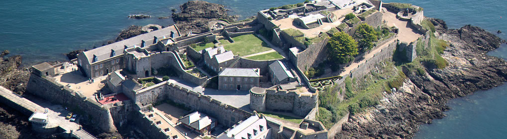
Fort Grey
Standing on the site of the earlier Château de Rocquaine, Fort Grey was completed in 1804. It was named Fort Grey in honour of General Charles, Early Grey of Howick, K.B., who was Governor of Guernsey from 1797 to 1807. Due to its shape however, it is affectionately known as the 'Cup and Saucer'. View site information sign...
Address: Route de la Lague, St Pierre du Bois. View map...
Perry's Guide: 20A5
Parking: Free parking available at Guernsey Pearl opposite.
Bus Routes: 11, 42, 91, 111
Fort Hommet
It is recorded that in 1680 there was a fortification with one gun on this site. By 1795 however the fort had been strengthened and additional gun positions constructed. In 1801 6 guns were recorded on the headland. The Martello tower was built in 1804. In 1856 a barrack block was constructed and this housed part of the Regular Army garrison until the First World War. It was later destroyed.
Address: Hommet headland, Castel. View map...
Accessible via footpaths from headland car park.
Perry's Guide: 13E1
Parking: Public car park at Hommet headland.
Bus Routes: 41, 91, 111
Fort Le Marchant
A fort has stood on this site since at least 1680. At the end of the18th century, when fears of French invasion were prompting new fortifications all around Guernsey's coast, the original fortification, known as Fort L'Angle, was expanded. The work was completed in 1805 and the new fort named after the then Lieutenant Bailiff Eleazar Le Marchant. In 1854 a large barracks was built on the landward side of the fort, surrounded by a defensive ditch. The barracks have since been demolished and the ditch filled.
Address: L'Ancresse Common, Vale. View map...
Accessible via footpath from Le Catelain or L'Ancresse Bay public car parks.
Perry's Guide: 7F1
Parking: Public car parks at Le Catelain or L'Ancresse Bay.
Bus Routes: 11, 91
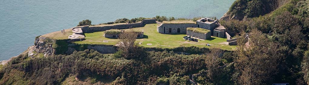
Fort Pezeries
A fort has stood on this spot since at least 1680. During the 18th century the gun platform was extended and musket steps added. Later the magazine was built and the parapet strengthened. By 1842 the fort had fallen into disrepair. Now three 18 pounder cannons guard Rocquaine Bay once again.
Address: Pleinmont, Torteval. View map...
Accessible via pedestrian road from Portelet Harbour or via cliff path from Pleinmont headland.
Perry's Guide: 32B1
Parking: Public car park at Portelet or Pleinmont headland.
Bus Routes: 11, 91, 111
Star Fort
The fort was built in 1811. Records indicate that 100 men were used in its construction and when complete it mounted six guns, one on each point of the star. Star forts were by their nature temporary constructions and the survival of intact and unmodified examples is rare. As evidence of the earthworks remains at Pembroke this is an important example of military engineering.
Address: Pembroke headland, Vale. View map...
Accessible from Pembroke Bay or Baie de la Jaonneuse car parks.
Perry's Guide: 6C1
Parking: Public car parks at Pembroke Bay or Baie de la Jaonneuse.
Bus Routes: 11, 91